中国地理概览 | China Geographic Overview
中国地理概览 | China Geographic Overview
地形与地貌 / Terrain & Landscape
中国国土面积约960万平方公里,地形从西向东呈三级阶梯状下降:西部青藏高原(平均海拔4,000米以上)→中部高原盆地(黄土高原、四川盆地)→东部平原丘陵(华北平原、长江三角洲)。这一地形格局决定了中国的河流走向——长江、黄河均自西向东入海。
China covers ~9.6 million km², with terrain descending in three steps from west to east: the Tibetan Plateau in the west (avg. elevation 4,000m+) → central plateaus and basins (Loess Plateau, Sichuan Basin) → eastern plains and hills (North China Plain, Yangtze Delta). This topography determines river flow — both the Yangtze and Yellow Rivers run west to east to the sea.
气候多样性 / Climate Diversity
中国跨越热带、亚热带、温带、寒温带和高原气候五个气候带。海南岛全年温暖如夏,黑龙江冬季最低可达-40°C,新疆夏季高温超40°C,西藏高原紫外线强烈。旅行前务必了解目的地气候特点。
China spans five climate zones: tropical, subtropical, temperate, cold temperate, and plateau. Hainan Island is warm year-round; Heilongjiang can reach -40°C in winter; Xinjiang exceeds 40°C in summer; Tibet has intense UV radiation. Always research your destination's climate before traveling.
旅行地理分区 / Travel Regions
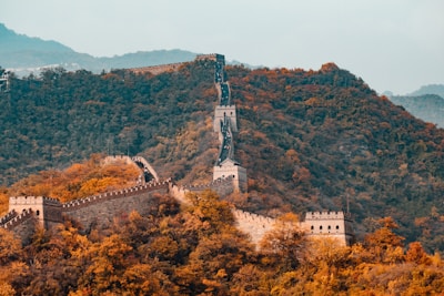
- 华北:北京、长城、黄土高原
- 华东:上海、苏州、杭州、黄山
- 华南:广州、桂林、厦门
- 西南:成都、云南、西藏
- 西北:西安、敦煌、新疆
- 东北:哈尔滨、长白山
延伸阅读 / Related Reads
- 中国高铁出行完全指南 | Complete Guide to China's High-Speed Rail
- 来华游客必备清单:证件/通讯/支付一站搞定 | Essential Checklist for Visitors to China
- 中国高铁乘车全攻略(境外游客版) | Complete HSR Guide for Foreign Tourists
- 中国景区门票预约与排队技巧 | Booking Tickets and Beating Queues at Chinese Attractions
- 华东五城10日经典环线 | 10-Day East China Five-City Loop
- 中国丝绸制品 | Silk Products from China
- 夜市烧烤摊的烟火气,教我别只找网红餐厅 | Smoke from a Night Grill Taught Me Not to Only Chase Viral Restaurants
- 支付宝绑定国际银行卡实操 | Alipay Foreign Card Binding Walkthrough
- 大理先让我学会的,不是看风景,而是在古城外把脚步放稳 | What Dali Taught Me First Was Not the View, but How to Steady My Steps Outside the Old Town
- 哈尔滨冬天的第一口热汤,救了我冻僵的旅行计划 | The First Bowl of Hot Soup in Harbin Saved My Frozen Travel Plan
- 春节期间最值得去的古镇 | Best Ancient Towns to Visit During Spring Festival
- 深圳夜里的便利店,让我看见中国城市的另一种安全感 | A Convenience Store at Night in Shenzhen Showed Me Another Kind of Urban Safety
- 陪爸妈在湖州的五月细雨里找饭馆,我才知道一家人最稳定的路线其实是“先坐下” | Looking for a Restaurant with My Parents in Huzhou Rain, I Learned the Steadiest Family Plan Begins with Sitting Down
- 海南环岛自驾7天:三亚万宁博鳌 | 7-Day Hainan Island Drive: Sanya, Wanning & Boao
- 昆明蓝花楹城市漫步:把春天走成一条紫色街巷 | A Jacaranda Walk in Kunming: Turning Spring into a Purple Street
Comments (0)